Who is a member?
Our members are the local governments of Massachusetts and their elected and appointed leadership.
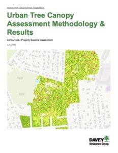
 In a shift toward a more proactive approach for management of city-owned land, the Worcester Conservation Commission worked with the Davey Resource Group to conduct a forest health assessment of more than 850 acres earlier this year.
“The primary goal of the project was to develop a better understanding of the existing conditions of these properties and our forests’ health, and develop informed strategies to manage the properties to improve the function of the ecosystem services and recreational benefits that they provide for our community,” said Michelle Smit, assistant chief development officer for Planning and Regulatory Services, and Conservation Planner Eric Flint, in a statement to the MMA.
The assessment primarily used aerial imagery to gather high-level information about tree canopy coverage to develop a baseline record of tree cover and its condition. Field work was then conducted to verify the results and gain insight into specific issues that might be causing poor canopy health.
These in-depth field assessments were done for eight properties: Cascades East, Crow Hill, Fitzgerald Brook, God’s Acre, Parsons Cider Mill, Patch Pond and Reservoir, Perkins Farm, and the Wayside Conservation area. The properties were selected based on size, canopy health, and the presence of existing documentation, with larger, poor-health, or documentation-deficient areas prioritized. The individual field studies evaluated forest health and structure, as well as encroachment and invasive species.
Smit and Flint said a major takeaway from the report is the quantifiable values associated with the ecosystem services provided by the forests. The assessment estimated that the roughly 850 acres of evaluated forests provide an annual value of $156,224 associated with air pollutant removal, stormwater runoff reduction, and carbon sequestration. The study found that the forests sequester roughly 798 tons of carbon annually, and store roughly 24,170 tons of carbon over their lifetime, which is valued at $4.1 million. The study estimated that the land intercepts about 950,220 gallons of stormwater each year.
“There is a lot of work we need to do to better steward these properties, and we do need resources to do so,” Smit and Flint said in a statement. “The site-specific baseline reports revealed a large presence of invasive species on most of the properties, which threaten the unique habitats the properties were acquired to protect and degrade the value of the ecosystem services the land provides.”
They added that the report also identified “a very real need for long-overdue land management basics,” including property boundary demarcation, signage, and trail maintenance.
The $50,000 project received a $40,000 grant from the Massachusetts Department of Conservation and Recreation’s Urban and Community Forestry Challenge Grant program (funded through the U.S. Forest Service). The remaining cost was covered using department operating funds.
Smit and Flint said that the city plans to address the report’s management recommendations alongside community partners, especially where they align with other citywide plans, including the Open Space and Recreation Plan, Green Worcester, Worcester Now | Next, and the ongoing Hazard Mitigation Plan update.
“Ultimately, this work emphasizes the importance of and need for additional resources to manage these lands more actively to enhance the ecosystem services and to maintain and promote the recreational amenities the properties were acquired for,” they said.