Who is a member?
Our members are the local governments of Massachusetts and their elected and appointed leadership.
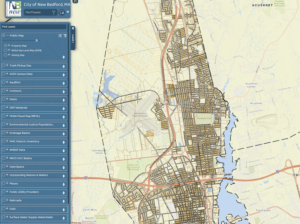
New Bedford’s new digital mapping and property information tool provides in-depth details about properties located in the city.
New Bedford has launched a new digital mapping and property information tool to provide an in-depth look at property details across the city.
The tool, which is open for use to the public, uses AxisGIS and CAI Technologies and features an integration with Google Maps. Residents can look up their own property as well as those of abutters.
“The new property lookup tool offers New Bedford residents an enormous amount of information,” Mayor Jon Mitchell said in a statement. “We’re always looking for opportunities to provide better services and innovative tools to our residents, and this digital upgrade delivers that, right from their smartphones or home computers.”
The tool includes basic information about zoning, property details (lot size, number of bedrooms and bathrooms, and sale information), and tax information. Users can also choose from more than 20 additional layering options to see information related to water resources, open space, drainage basins, dams, census data, trash pickup and more. These layers can easily be toggled on and off, and the coloring saturation can be manually adjusted.
The tool is available on the New Bedford website in a couple different places, and can be accessed directly at next.axisgis.com/New_BedfordMA. The city has included a quick user guide, as well as a more in-depth help section, and the tool has a section for users to leave feedback.